Parcels
Parcels
| Name | App Type | Scope | Auth Type | Resource URI | Civic Platform version |
|---|---|---|---|---|---|
| Get All Parcel Addresses | All | parcels | No auth required | GET /v4/parcels/{id}/addresses | 7.3.2 |
| Get All Parcel Conditions | All | parcels | Access token | GET /v4/parcels/{parcelId}/conditions | 8.0.0 |
| Get All Parcel Owners | All | parcels | No auth required | GET /v4/parcels/{parcelId}/owners | 7.3.2 |
| Get All Parcels | All | parcels | No auth required | GET /v4/parcels | 7.3.2 |
| Get Parcel | All | parcels | No auth required | GET /v4/parcels/{id} | 7.3.2 |
Overview:
Parcels
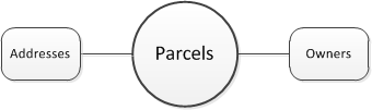
The system uses the parcels object to define a piece of land with a specific location and legally defined boundaries. The county assessor’s office typically maintains information about all land parcels within its jurisdiction and imports parcel information, from a file, into the system.
Parcels comprise a central component of a land management solution or building permit solution. Owner, address, contact, fee, and application records exist in relation to work on a particular parcel. For example, an applicant may want to build an apartment complex on a particular parcel.